Resources
This page contains some key resources on walking and cycling, including an archive of the documents produced by the Australian Bicycle Council.
| Date Added | |||
|---|---|---|---|
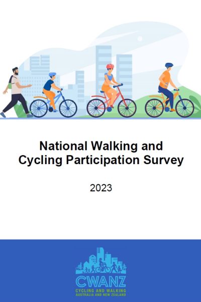 |
National Walking and Cycling Participation Survey 2023 CWANZ The National Walking and Cycling Participation Survey (NWCPS) provides insight into walking and cycling activity across Australia and is a successor to the National Cycling Participation Survey which was conducted biennially from 2011 to 2019. |
22/09/2023 | View |
 |
Transport Accessibility Strategy Department of Transport and Planning The Victorian Government is working to ensure our public transport network is inclusive and accessible for all Victorians. In Victoria, 1.1 million people have either a physical or non-physical disability. Our ageing population and those with other mobility barriers also need accessibility support on the transport network. |
19/05/2023 | View |
 |
Active Travel to School Program: Walk to School City of Whittlesea PROGRAM FEATURES:
DATE IMPLEMENTED: Not available COST: Not available |
14/02/2023 | View |
|
Active Travel to School Program: Stroll & Roll Latrobe City Council PROGRAM FEATURES:
DATE IMPLEMENTED: 30 January 2022 COST OF PROGRAM: Not available COST FOR USERS: None RESULTS OF EVALUATION: Not available |
14/02/2023 | View |
|
Active Travel to School Program: Whittlesea Active Travel in Schools City of Whittlesea PROGRAM FEATURES:
DATE IMPLEMENTED: 2013 COST: Not available RESULTS OF EVALUATION: Not available |
30/01/2023 | View |
|
Active Travel to School Program: Walk to School Month City of Moonee Valley PROGRAM FEATURES:
DATE IMPLEMENTED: Not available COST: Not available RESULTS OF EVALUATION: Not available |
30/01/2023 | View |
|
Active Travel to School Program: Walk to School (VicHealth) VicHealth PROGRAM FEATURES:
DATE IMPLEMENTED: Not available COST OF PROGRAM: Not available COST FOR USERS: None RESULTS OF EVALUATION: Not available |
30/01/2023 | View |
|
Active Travel to School Program: The Healthy Schools Achievement Program Cancer Council Victoria PROGRAM FEATURES:
DATE IMPLEMENTED: Not available COST: Not available. Free for schools. RESULTS OF EVALUATION: Not available |
30/01/2023 | View |
|
Active Travel to School Program: Open Streets Bicycle Network PROGRAM FEATURES:
DATE IMPLEMENTED: Not available COST: Not available ADDITIONAL INFORMATION: Part of suite of programs to help break down the barriers that prevent more students from staying active on their journey to school. Culminates in National Ride2School Day. RESULTS OF EVALUATION: Not available |
16/01/2023 | View |
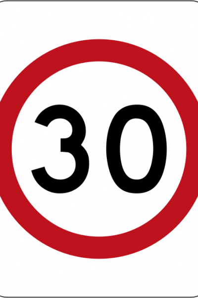 |
Safer Speeds Case Study - City of Yarra, Melbourne STREET NAMES: Treatment area located between Alexandra Parade (north), Hoddle Street (east), Johnston Street (south) and Nicholson Street (west) SUBURBS: Fitzroy and Collingwood MUNICIPALITY: City of Yarra, Melbourne STATE & COUNTRY: Victoria, Australia SPEED REDUCTION: From 40 km/h to 30 km/h DATE IMPLEMENTED: December 2019 SCHEME INCLUDED:
COST: Not available ADDITIONAL INFORMATION: Non-treatment area for control purposes located adjacent to the treatment area. WHY?
LESSONS LEARNED: The scheme included signage only. With additional infrastructure calming measures such as curb extensions, speed bumps, intersection platforms, further speed reduction improvements would be expected. The choice control region for this study was not seen as ideal. |
20/12/2022 | |
 |
Safer Speeds Case Study - Melbourne Shopping Strips Department of Transport, Victoria LOCATION: Multiple busy shopping strip centres SPEED REDUCTION: 50 km/h to 40km/h MUNICIPALITY: Multiple STATE & COUNTRY: Victoria, Australia SCHEME INCLUDED:
DATE IMPLEMENTED: Various COST: Not available ADDITIONAL INFORMATION: Introduced in areas of high pedestrian activity LESSONS LEARNED:
|
20/12/2022 | View |
|
Safer Speeds Case Study - Melbourne City of Melbourne STREET NAME: Local roads across inner Melbourne SUBURB: Melbourne MUNICIPALITY: City of Melbourne STATE & COUNTRY: Victoria, Australia SPEED REDUCTION: From 50 km/h to 40 km/h DATE IMPLEMENTED: September 2022 - ongoing SCHEME INCLUDED:
COST: Not available ADDITIONAL INFORMATION:
RESULTS OF EVALUATION: Not available |
19/12/2022 | View |
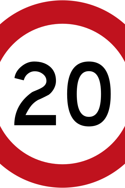 |
Safer Speeds Case Study - Little Streets, Melbourne City of Melbourne STREET NAME: One-way sections of Flinders Lane, Little Collins Street, Little Bourke Street and Little Lonsdale Street SUBURB: Melbourne MUNICIPALITY: City of Melbourne STATE & COUNTRY: Victoria, Australia SPEED REDUCTION: From 40 km/h to 20 km/h DATE IMPLEMENTED: September 2020 SCHEME INCLUDED:
COST: Not available ADDITIONAL INFORMATION:
RESULTS OF EVALUATION: Not available |
19/12/2022 | View |
|
Safer Speeds Case Study - Fitzroy & Collingwood, Victoria STREET NAME: Treatment area located between Alexandra Parade (north), Hoddle Street (east), Johnston Street (south) and Nicholson Street (west) SUBURB: Fitzroy and Collingwood MUNICIPALITY: City of Yarra, Melbourne STATE & COUNTRY: Victoria, Australia SPEED REDUCTION: From 40 km/h to 30 km/h DATE IMPLEMENTED: January 2020 (trial start October 2018) SCHEME INCLUDED:
COST: Not available ADDITIONAL INFORMATION:
Observations of pedestrian and cyclist activity were undertaken at a limited number of locations within the treatment and non-treatment areas during three days before the trial implementation and three days at 12 months into the trial. The small number of locations and survey days limits the ability for general conclusions. The data shows a 12.7% drop in pedestrian activity (largely driven by a single site) and a 27.8% increase in cycling activity. LESSONS LEARNED: For some members of the community there was confusion about how the pedestrian priority at the crossings worked, how to determine when to enter and how to exit the roundabout. There are feelings of frustration caused by inconvenience to the driving experience which are perceived to be caused by the Wombat Crossings. Intercept surveys at the Wombat Crossings found people using them thought they created a more convenient walking experience however there was still concern about understanding how the crossings worked and the expectations of people walking and people driving. Information about the benefits of the crossings and the expectations of all road users would assist the community to understand the role they play in creating a pedestrian priority city centre. |
06/10/2022 | |
|
Bike It Baw Baw: Cyclist Safety Issues in the Baw Baw Shire Monash University Accident Research Centre The aim of the study was to identify the issues in Baw Baw Shire in Gippsland, Victoria, related to the safety of on-road cyclists. Safety concerns specific to the Baw Baw Shire are identified and potential countermeasures that may improve cyclist safety are discussed. |
12/04/2022 | View |
|
Cyclists and red lights – a study of the behaviour of commuter cyclist in Melbourne The National Academies of Sciences, Engineering, and Medicine The primary aim of this research was to investigate the behaviours of cyclists and their interactions with vehicles at signalised intersections.The results focus on the three types of behaviour at red lights. Males were more likely to continue through the red light than females and the majority of males who rode through red lights were runners. The findings are important as they differentiate between the types of red light running behaviour and highlight factors influencing cyclists risk exposure. |
12/04/2022 | View |
|
Cyclist bunch riding: a review of the literature Monash University Accident Research Centre This report is a review of the literature on cyclists who ride in large groups or bunches on public roads. The research was conducted following the Victorian State Coroner’s investigation into the death of an elderly pedestrian, following a collision with a cyclist who was riding in a bunch. The aims of the review were to understand the behaviour of bunch riders, particularly the behaviours that may contribute to increased risk of collision and to make recommendations for effective enforcement and countermeasure strategies for this road user group. |
12/04/2022 | View |
|
Naturalistic cycling study: identifying risk factors for on-road commuter cyclists Amy Gillett Foundation This study identified risk factors for collisions/near-collisions involving on-road commuter cyclists and drivers. A naturalistic cycling study was conducted in Melbourne, Australia, with cyclists wearing helmet-mounted video cameras. Video recordings captured cyclists’ perspective of the road and traffic behaviours including head checks, reactions and manoeuvres. |
12/04/2022 | View |
 |
Painting a designated space: cyclist and driver compliance at cycling infrastructure at intersections Amy Gillett Foundation This study evaluated cyclist and driver compliance at cycling infrastructure at signalised intersections to determine the effectiveness of the infrastructure in creating a designated space for cyclists. A cross-sectional observational study was conducted during peak travel times at six sites in Melbourne in March 2009. |
12/04/2022 | View |
|
Cyclist safety: an investigation of how cyclists and drivers interact on the roads Monash University Cyclists are vulnerable road users and the most severe injury outcomes for on-road cyclists are from collisions involving a motor vehicle. Research undertaken in this thesis aimed to identify contributing factors in unsafe cyclist-driver events to inform efforts to reduce the incidence of cyclist-driver crashes and cyclist injury severity outcomes. |
12/04/2022 | View |
 |
Riding through red lights: The rate, characteristics and risk factors of non-compliant urban commuter cyclists Accident Analysis & Prevention This study determined the rate and associated factors of red light infringement among urban commuter cyclists. A cross-sectional observational study was conducted using a covert video camera to record cyclists at 10 sites across metropolitan Melbourne, Australia from October 2008 to April 2009. |
12/04/2022 | View |
 |
MACCS Monash Alfred cyclist crash study Monash University Accident Research Centre Current primary data sources on mechanisms of Victorian bicycle crashes lack sufficient detail to draw clear conclusions on crash causation. Nor are these data adequate to link specific crash mechanisms to characteristic injury outcomes. The Monash Alfred Cycle Crash Study (MACCS) aimed to redress these data deficiencies through piloting an in-depth crash investigation study focused on cyclists. In-depth data were collected from 158 patients presenting to The Alfred and Sandringham Hospital Emergency Departments who were riders of bicycles involved in a crash. Information collected covered pre-crash factors pertaining to environment and cyclist/driver behaviour, crash mechanism, and injury outcomes from hospital records. Analyses of these data provide insight on crash causation and associated injury burdens which can inform the development, prioritisation and targeting of effective countermeasures. |
12/04/2022 | View |
 |
Road crashes involving bike riders in Victoria, 2002–2012 Amy Gillett Foundation This study is a multi-year analysis of bicycle rider crash statistics undertaken using Victorian CrashStats. It clearly shows that there are distinct differences in the crash profiles of fatal bike rider crashes compared to non-fatal crashes. |
12/04/2022 | View |
 |
Bike Law Amy Gillett Foundation A bike rider’s guide to road rules in Victoria. This guide outlines the essential road rules you need to know as a bike rider. |
12/04/2022 | View |
 |
BikeSpot CrowdSpot and the Amy Gillett Foundation Victoria is still striving to become a world-class cycling location. A lack of safety is the major barrier to people getting on their bikes. How it feels to ride a bicycle has an impact on people's willingness to ride. BikeSpot 2020 provides the opportunity for all Victorians to share their perceptions of cycling safety and help develop new insights for the prioritisation of cycling safety improvements. |
07/04/2022 | View |
 |
National Walking and Cycling Participation Survey 2021 - Victoria Cycling and Walking Australia and New Zealand The National Walking and Cycling Participation Survey (NWCPS) provides insight into walking and cycling activity across Australia and is a successor to the National Cycling Participation Survey which was conducted biennially from 2011 to 2019. |
31/08/2021 | View |
|
New Paths on New Projects Department of Transport, Victoria Every major new transport project – from North East Link to the West Gate Tunnel – now includes new or upgraded infrastructure for cyclists and pedestrians. |
16/07/2021 | View |
|
Active Transport Victoria Department of Transport, Victoria The Victorian Government has committed $15.3 million in the Victorian Budget 2019/20 towards Active Transport Victoria projects to deliver key upgrades for safer walking and cycling. |
16/07/2021 | View |
|
Safer CBD Cycling Connections Department of Transport, Victoria 100kms of new and improved cycling routes across key inner-city suburbs to make it easier and safer for people to cycle to and from the CBD. |
16/07/2021 | View |
 |
Strategic Cycling Corridors Department of Transport, Victoria Strategic Cycling Corridors are important transport routes for cycling and are a subset of the Principal Bicycle Network. |
16/07/2021 | View |
 |
Victorian Road Safety Strategy 2021-2030 Department of Transport, Victoria The Victorian Road Safety Strategy 2021-2030 aims to halve deaths by 2030 and put us on a strong path to eliminate all road deaths by 2050. |
15/07/2021 | View |
 |
Victorian Cycling Strategy 2019-2028 Department of Transport, Victoria The Victorian Cycling Strategy 2018-2028 is guiding planning and investment to get more people to cycle for transport – to work, school, public transport and shops – in Melbourne and the regions. |
20/05/2021 | View |