Resources
This page contains some key resources on walking and cycling, including an archive of the documents produced by the Australian Bicycle Council.
| Date Added | |||
|---|---|---|---|
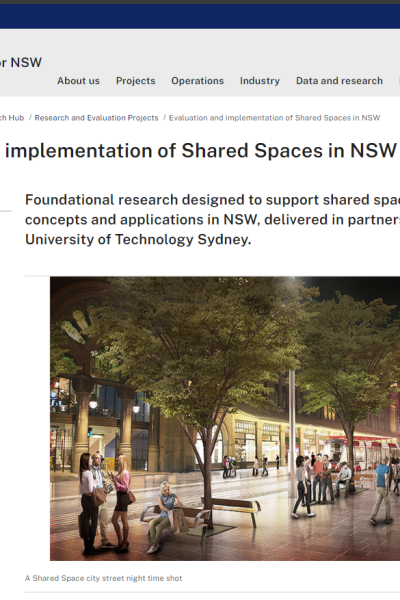 |
Evaluation and implementation of Shared Spaces in NSW Transport for NSW Foundational research designed to support shared space design concepts and applications in NSW, delivered by Transport for NSW in partnership with the University of Technology Sydney. |
16/02/2024 | View |
 |
National Walking and Cycling Participation Survey 2023 CWANZ The National Walking and Cycling Participation Survey (NWCPS) provides insight into walking and cycling activity across Australia and is a successor to the National Cycling Participation Survey which was conducted biennially from 2011 to 2019. |
22/09/2023 | View |
 |
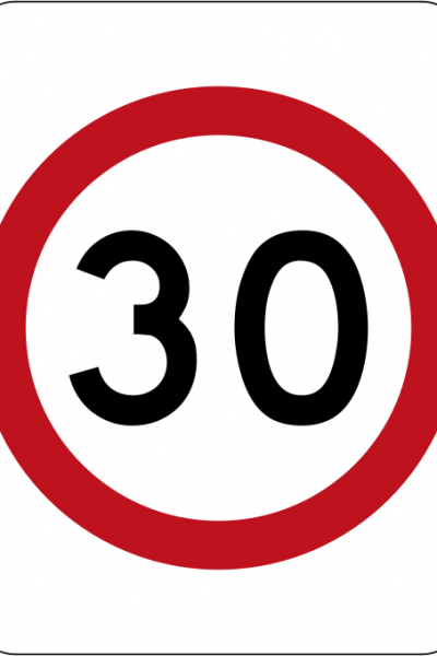
Speed zones Transport for NSW Speed limits are set to allow you to safely respond to potential risks on the road. Lower speed limits apply in areas where there are more people and vehicles. This is to reduce the chance of crashes and serious injuries. Includes:
|
22/09/2023 | View |
 |
Disability Inclusion Action Plan 2018 – 2022 Transport for NSW The NSW Government is funding numerous projects under the Transport Access Program to upgrade train stations, ferry wharves and interchanges. New infrastructure, such as the Sydney Metro Northwest and the CBD and South East Light Rail, are being built to the very highest standards of accessibility. We have invested in new trains, buses and ferries – all which have improved accessibility features. The Disability Inclusion Action Plan 2018-2022 builds upon the successes of the previous plan, the Disability Action Plan 2012-2017, to set an ambitious agenda for the next five years. This document presents a vision of a more accessible future for transport in NSW. More importantly, it outlines concrete, measurable steps towards achieving that vision. |
19/05/2023 | View |
 |
Evaluation of permanent 40km/h speed limits: Summary report Transport for NSW |
17/05/2023 | View |
 |
40 km/h speed limits in high volume pedestrian areas Transport for NSW A guide to identifying and implementing 40 km/h speed limits in high volume pedestrian areas. |
15/05/2023 | View |
 |
Get NSW Active Transport for NSW The Get NSW Active program provides local councils with funding for projects that create safe, easy and enjoyable walking and cycling trips. These trips help to relieve pressure on our roads and public transport networks and are part of a healthy lifestyle for NSW communities. |
01/05/2023 | View |
 |
Active Travel to School Program: Switch it Up NSW Education PROGRAM FEATURES:
DATE IMPLEMENTED: Not available COST: Not available RESULTS OF EVALUATION: Not available |
17/01/2023 | View |
|
Active Travel to School Program: BikeReady (NSW) NSW Health PROGRAM FEATURES: Resource to support communities and schools to encourage more young people to walk or cycle, and to involve young people in the development and implementation of an active travel initiative. Includes:
DATE IMPLEMENTED: Not available COST: Not available RESULTS OF EVALUATION: Not available |
17/01/2023 | View |
 |
Safer Speeds Case Study - High Pedestrian Activity Areas, NSW Transport for NSW LOCATION: Multiple SUBURB: Multiple MUNICIPALITY: Multiple STATE & COUNTRY: New South Wales, Australia SPEED REDUCTION: Various to 40 km/h DATE IMPLEMENTED: 2003 SCHEME INCLUDED:
COST: Not available ADDITIONAL INFORMATION:
LESSONS LEARNED:
|
20/12/2022 | View |
 |
Safer Speeds Case Study - Manly & Liverpool, NSW Transport for NSW STREET NAME: Multiple SUBURB: Manly and Liverpool MUNICIPALITY: Northern Beaches Council and Liverpool City Council STATE & COUNTRY: New South Wales, Australia SPEED REDUCTION: From 40 km/h to 30 km/h DATE IMPLEMENTED: July 2020 SCHEME INCLUDED:
COST: Not available RESULTS OF EVALUATION: Not available |
19/12/2022 | View |
|
Safer Speeds Case Study - Sydney CBD Transport for NSW STREET NAME: Multiple SUBURB: Sydney MUNICIPALITY: City of Sydney STATE & COUNTRY: New South Wales, Australia SPEED REDUCTION: From 50 km/h to 40 km/h DATE IMPLEMENTED: 2016, August 2019 SCHEME INCLUDED:
COST: Not available ADDITIONAL INFORMATION:
RESULTS OF EVALUATION: Not available |
19/12/2022 | View |
 |
Active Transport Strategy Transport for NSW The NSW Government wants walking and bike riding, known as active transport, to be the preferred way to make short trips and a viable, safe and efficient option for longer trips. We estimate that more than 1.5 billion walking and bike riding trips are taken per year across New South Wales. We want to double this number in 20 years. NSW Government’s Future Transport Strategy sets the vision for safe, healthy, sustainable, accessible and integrated journeys in NSW. This Active Transport Strategy draws on the Future Transport Strategy and its vision for walking, bike riding and personal mobility. The Strategy provides a plan to guide planning, investment and priority actions for active transport across NSW. |
16/12/2022 | View |
 |
Movement & Place and the design of safe & successful places iMove Future Transport Strategy 2056 sets the 40-year vision and framework for customer mobility in NSW. As part of this vision, the Strategy recognises the importance of shaping our future transport spaces to ensure balance between movement and place. To support the development of successful places, the Movement & Place Framework promotes the urban design principles that allow local communities to come together in places with vehicle movement, thereby supporting social and economic growth. The purpose of this research is to use the Movement & Place Framework and Safe System approach to develop a series of evidence-based design principles and guidelines for balancing vehicle movement and place-making, to enhance the development of safe and successful places. Using virtual reality (VR) and pedestrian tracking technology, the project aims to better understand relationships between pedestrian-oriented urban design elemental variables and safe system treatments to improve the human experience and safety of pedestrians. Outcomes from this research will facilitate the implementation and evaluation of successful places in collaboration with local councils to determine the real-life impact of different place-making and safety variables. |
14/06/2022 | View |
 |
Movement and Place Transport for NSW Movement and Place is a cross-government framework for planning, designing and managing our transport networks to maximise benefits for the people and places they serve. |
14/06/2022 | View |
 |
NSW State Infrastructure Strategy Infrastructure NSW The State Infrastructure Strategy is a 20-year infrastructure investment plan for the NSW Government that places strategic fit and economic merit at the centre of investment decisions. The strategy assesses infrastructure problems and solutions, and provides recommendations to best grow the State's economy, enhance productivity and improve living standards for our NSW community. It is updated every five years. |
12/04/2022 | View |
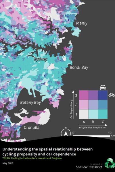 |
Cycling Propensity Transport for NSW This dataset contains the propensity index for cycling across different areas. It also contains the report that examines spatial relationship between areas with high propensity for cycling with high concentrations of short distance car trips. |
12/04/2022 | View |
 |
Road rules for bicycle riders Transport for NSW |
12/04/2022 | View |
|
Active Transport to School Transport for NSW |
12/04/2022 | View |
 |
Trip Planner Transport for NSW |
12/04/2022 | View |
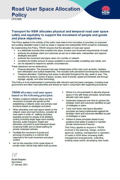 |
Providing for Walking and Cycling in Transport Projects Policy Transport for NSW Transport for NSW allocates physical and temporal road user space safely and equitably to support the movement of people and goods and place objectives |
07/04/2022 | View |
 |
Household Travel Survey (HTS) Transport for NSW The most comprehensive source of personal travel data for the Sydney Greater Metropolitan Area (GMA). Find out how and why people travel. |
07/04/2022 | View |
 |
National Walking and Cycling Participation Survey 2021 - NSW Cycling and Walking Australia and New Zealand The National Walking and Cycling Participation Survey provides insight into walking and cycling activity across Australia and is a successor to the National Cycling Participation Survey which was conducted biennially from 2011 to 2019. |
02/09/2021 | View |
 |
Sydney City Centre Access Strategy Transport for NSW The Sydney City Centre Access Strategy gets our city centre moving, addresses growth and will lead to increased investment for our future. |
03/08/2021 | View |
| NSW Regional Transport Plans Transport for NSW Major gains on key transport infrastructure and services for the region’s growing communities. Regions: |
03/08/2021 | View | |
| NSW Long Term Transport Master Plan Transport for NSW The NSW Long Term Transport Master Plan sets the framework for the NSW Government to deliver an integrated, modern transport system that puts the customer first. The Master Plan plays two fundamental roles. First, it identifies the challenges that the transport system in NSW needs to address to support the State’s economic and social performance over the next 20 years. It guides decision-makers to prioritise actions that address the most pressing challenges. |
03/08/2021 | View | |
 |
Walking and Cycling Program Guidelines Transport for NSW These guidelines outline the priority weighting system that will be used to assess walking and cycling proposals submitted to the NSW Government for funding. |
03/08/2021 | View |
 |
Sydney's Walking Future Transport for NSW The NSW Government’s goal is to get people in Sydney walking more through actions that make it a more convenient, better connected and safer mode of transport. The more people walk, the more socially engaged the community becomes and the safer people feel when walking for transport. |
03/08/2021 | View |
 |
Household Travel Survey Report: Sydney 2012/13 Transport for NSW Understand the travel behaviour and trends of the residents of Sydney Greater Metropolitan Area during 2012/2013, together with trends over the previous decade. |
03/08/2021 | View |
 |
Sydney Cycling Survey 2011 Transport for NSW The NSW 2021 strategic business plan establishes a target to more than double the mode share of cycling among trips up to 10 km in the Sydney Greater Metropolitan Area by 2016. In order to achieve this target, Roads and Maritime Services (RMS) and the Bureau of Transport Statistics (BTS) commissioned Sinclair Knight Merz to develop a survey method to monitor performance towards this target. This survey was first undertaken in November 2010 and as referred to as the Sydney Cycling Survey (SCS) 2010. |
03/08/2021 | View |
| Future Transport Transport for NSW Future Transport sets the direction for connecting people, communities and businesses in NSW to provide a successful and thriving future. |
03/08/2021 | View | |
 |
NSW Road Safety Strategy 2012-21 Transport for NSW The NSW Government is committed to improving road safety for the community and plans to make NSW roads the safest in the country. In 2011, we worked with the NSW Road Safety Advisory Council and the heavy vehicle industry to develop the NSW Road Safety Strategy 2012-2021. |
02/08/2021 | View |
| Sydney CBD to Parramatta Strategic Transport Plan Transport for NSW The Sydney CBD to Parramatta Strategic Transport Plan is a transport plan to improve the way people move along and around one of Sydney’s most important and busiest areas, the corridor between Sydney CBD and Parramatta. |
15/07/2021 | View | |
 |
Transport for NSW Economic Parameter Values Transport for NSW This document recommends economic parameter values for common benefits and costs in transport economic appraisals. By providing best-practice approaches and economic parameter values, this document supports the consistent application of cost-benefit analysis (CBA) across the NSW Transport cluster. |
15/07/2021 | View |
|
Economic Parameter Values Transport for NSW This spreadheet provides all tables in the Transport for NSW Economic Parameter Values. |
15/07/2021 | View |
 |
Cycleway Design Toolbox Transport for NSW Need description |
17/05/2021 | View |
 |
Walking Space Guide Transport for NSW The Walking Space Guide (Guide) provides a set of standards and tools to assist those responsible for Walking Spaces on streets, to ensure that sufficient space is provided to achieve comfortable environments which encourage people to walk. The Guide offers a clear, consistent set of standards and processes to be applied in designing, planning and implementing the amount of space to be provided according to the intensity of use. It is intended that designs are appropriate to the number of people using footpaths. This guide contains the method for carrying out a Walking Space assessment and offers guidance on how to understand the results. The guide includes an accompanying spreadsheet for recording data and calculating results. |
17/05/2021 | View |